Digital Dialogue Virtual Event Series Sponsors
SERIES EVENT SPONSORS
SERIES PATRON CIRCLE SPONSORS
FEDERAL DIALOGUE EVENT SPONSORS
AGENDA AND SPEAKERS

Federal Dialogue - November 18 | 2020
MAPPS continues a tradition of active participation in defining geospatial policy. During our Federal Programs events, MAPPS engages with government agencies and advocates on behalf of the geospatial profession. Overviews of advocacy, federal agency programs, and the roll of geospatial professionals will be emphasized during our Federal Dialogue.
Agenda-at-a-Glance
Agenda
Post-Election Legislative Update
John Copple, MAPPS Legislative Affairs Charirperson, Sanborn Map Company
Stefan Bailey, MAPPS Legislative Affairs Director, Prime Policy Group
How does the 2020 elections affect the geospatial profession? This update will focus on how the election results will change geospatial activities and priorities within the federal government.
Government Agencies Views on TopoBathy
Moderated by Mark Brooks, MAPPS President, Optimal GEO
Expert Panelists:
Mike Aslaksen, Chief of Remote Sensing Division, National Geodetic Survey NOAA
Jeffrey Danielson, CoNED Applications Project Chief USGS
Jason Stoker, Acting Chief, USGS NGP Topographic Data Services USGS
Cindy Thatcher, Elevation Planning and Management Lead, USGS
Jennifer Wozencraft, Director of the Joint Airborne Lidar Bathymetry Technical Center of Expertise (JALBTCX) USACE
Topobathymetric lidar has become synonymous with DEM development in both coastal and inland regions, with multiple agencies requiring varying . During this session, government agency representatives will discuss program requirements for topobathy data, how the data fulfills the mission of their programs, and their vision for how topobathy can be utilized in the future.
National Mapping Programs – Past, Present and Future Successes
Moderated by: Brian Raber, GISP, Merrick and Company
Expert Panelists:
Nancy Blyler, USACE Geospatial Community of Practice Lead, United States Army Corps of Engineers (USACE)
Vicki Lukas, Associate Director Core Science Systems, United States Geologic Survey (USGS)
Tony LaVoi, Geospatial Information Officer (GIO), National Oceanic and Atmospheric Administration (NOAA)
Kevin Gallagher, Core Science Systems, USGS Geologic and Topographic Mapping
The United Stated Federal Government is probably the largest creator and consumer of sophisticated geospatial data in the world. As such, several Federal agencies have developed sustainable geospatial programs that not only meet their agency mission requirements, but also cascade foundational data to local government, academia, and the private sector. Session panelists are comprised of three leading agencies which are pioneers and visionaries in the geospatial community. Panelist will summarize the lineage of their unique programs, explain current operational programs, then discuss short- and long-term visions. A dialogue with panelists shall focus on program success factors, innovative geospatial applications/analysis highlights, and describe methods to grow, share and develop data partnerships.
Topobathymetric Lidar Solutions
Presented by: Colin Cooper, Technical Domain Expert, Quantum Spatial
Airborne Topobathymetric Lidar has matured to become an indispensable technology used by a diverse community of earth scientists, hydrologists, surveyors, engineers and other professionals to define subsurface topography in both near shore and riverine environments in striking detail and accuracy. Federal Government agencies including USGS, NOAA and USACE were quick to embrace the use of topobathy lidar to support their mission requirements and have identified it as a key technology that will support the realization of a 3D National Terrain. The presentation will provide a brief overview of the technology, its operational parameters and constraints, data characteristics, applications and use cases.
What Else Can I Do With Topobathymetric data?
Presented by: Dr. Alvan "Al" Karlin, Senior Geospatial Scientist, Dewberry
Aerial topobathymetric lidar and acoustic bathymetry data have a long and storied history of serving scientific and surveying requirements for federal agencies, including the USGS, NOAA, NASA, and the Armed Forces. The mapping products generated from topobathymetric lidar are generally focused on navigation and shallow sea-floor bathymetry. Now, with interest in the 3D National Terrain Model, we look forward to newer technologies that can provide a diverse set of derived products for uses beyond the traditional navigation and bathymetry. This presentation will briefly review the newly emerging topobathymetric technologies with a focus not on the technology, but rather feature extraction, the types of products that can be generated and the applications that those products can support.
Speakers
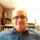
Mike Aslaksen
Chief of Remote Sensing Division, National Geodetic Survey NOAA

Mike Aslaksen is the Chief of the Remote Sensing Division within the National Geodetic Survey of NOAA. Mike has been with NOAA more than 25 years and has served in a variety of operational, technical, and policy positions ranging from performing field surveys supporting Nautical and Aeronautical Charting to serving as the Chief of Staff for NOAA’s Ocean Service. Mike’s education includes a Bachelor of Science from Old Dominion University and a Master of Science from The Johns Hopkins University.
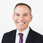
Stefan Bailey
Managing Director, Prime Policy Group

Stefan Bailey has spent two decades in Washington shaping the outcomes of consequential policy decisions. Prior to joining Prime Policy Group, Stefan served nearly ten years as a senior legislative staff member in the Senate and House of Representatives, where he developed a firm grasp of the intersection between policy and politics.
Stefan provides strategic counsel to a diverse array of corporate leaders, trade associations, non-profit executives, and lawmakers on a wide range of issues, and has earned a strong reputation for using bipartisan collaboration and creative thinking to leverage meaningful results. Stefan oversees the firm’s business development efforts and leads client teams in several public policy disciplines.

Jeffrey Danielson
CoNED Applications Project Chief

Jeff is a physical geographer working for the U.S. Geological Survey, Earth Resources Observation & Science (EROS) Center. His current work is leading the USGS Coastal National Elevation Database (CoNED) Applications Project. Danielson also leads inland bathymetry research for the 3D Elevation Program focusing specifically on inland elevation data integration. Danielson is the USGS co-chair on the Interagency Working Group for Ocean and Coastal Mapping (IWG-OCM) and JALBTCX representative.
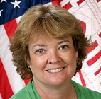
Nancy Byler
US Army Corps of Engineers (USACE) Geospatial Community of Practice

Nancy Blyler leads the US Army Corps of Engineers (USACE) Geospatial Community of Practice. She develops guidance and sets policy with respect to Geospatial Technologies for the USACE. Ms Blyler manages the USACE Enterprise Geospatial Engineering System (EGES) Program, which entails developing a comprehensive approach to implementing geospatial technology focusing on standardizing geospatial data and tools across USACE. Ms Blyler is also USACE’s primary liaison to the Federal Geographic Data Committee (FGDC), is a member of the Defense Installation Spatial Data Infrastructure (DISDI) Working Group, and serves on FEMA’s Technical Mapping Advisory Committee (TMAC). She is the HQ proponent for USACE’s GIS, Remote Sensing and Survey/Mapping courses. Prior to joining HQ in 1995, Ms Blyler worked at the Topographic Engineering Center (TEC) developing tactical military GIS applications supporting the war fighter community. Ms Blyler has also held positions with the Defense Mapping Agency as a hydrographic cartographer and US Dept of Agriculture as an imagery analyst. Ms Blyler holds a MS in Spatial Information Engineering from the University of Maine, a MS in Cartographic and Geographic Science from George Mason University and a BA in Geography from George Mason University.
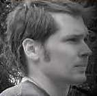
Colin Cooper
Technical Domain Expert

As a technical domain expert for Quantum Spatial, Colin has extensive experience working with raw LiDAR data and has pioneered much of Quantum Spatial’s processing workflow for NIR and topo-bathymetric LiDAR, including hydro-flattening, intensity normalization, and point feature coding. Colin holds an M.S. in Geography/GIS and minor in Marine Resource Management (Oregon State University) and a B.S. in Environmental Science (University of Delaware). He is directly involved with the collection, processing and analysis of remotely sensed data including LiDAR (NIR and bathymetric), TIR Imagery, and aerial photography.
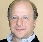
John Copple
CEO

Mr. Copple is the Chief Executive Officer of The Sanborn Map Company, Inc., a position held for 17 years. His career includes satellite, aerial, drone, and ground remote sensing technologies. Mr. Copple is a strong believer in the value of remote sensing technologies and geographic information systems and has traveled extensively developing business both domestically and internationally.
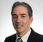
Kevin T Gallagher
Core Science Systems

Mr. Gallagher oversees the USGS Geologic and Topographic Mapping, Geological and Geophysical Data Preservation, Biological Information, and Science Informatics Programs, as well as the world's largest Earth Science Library.
From 2002-2010, Mr. Gallagher served as the USGS Chief Information officer and Chief Technology Officer where he oversaw the operation of information technology systems and networks supporting bureau wide computing and telecommunications.
Before joining the USGS, Mr. Gallagher held a number of information technology and management positions at various Federal agencies, including Chief of the Operations Division of the U.S. Coast Guard Operations Systems Center, and Software Developer with the Department of the Navy and Naval Research Laboratory.
Mr. Gallagher holds a master's degree in information systems from Syracuse University, a Chief Information Officer Certificate from the National Defense University, and a Bachelor of Science degree in Management Information Systems from James Madison University. He has also completed the Harvard Senior Executive Fellows Program at Harvard University.

Dr. Alvan "Al" Karlin
Sr. Geospatial Scientist

Dr. "Al" Karlin has over 25 years of professional experience in GIS and Remote Sensing in addition to over 30 years in academia. Dr. Karlin started his professional career at the University of Arkansas as a tenured professor, with dual appointments in the Departments of Computer and Information Science, and Engineering Technology. After leaving the university, he spent a brief period in the private sector before taking a position as a Senior Scientist with the Southwest Florida Water Management District. Dr. Karlin is active in the ASPRS and has served two terms as President of the Florida Region. He is an ASPRS Certified Mapping Scientist and a GISP.
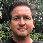
Tony LaVoi
Acting NOAA Chief Data Officer

Tony LaVoi currently serves as the National Oceanic and Atmospheric Administration (NOAA) Acting Chief Data Officer (CDO), as well as the U.S. Department of Commerce’s Senior Agency Official for Geospatial Information. Prior roles in NOAA include serving as the NOAA Geospatial Information Officer (GIO), as well as a National Ocean Service Information Services Director. As the NOAA GIO, he was the focal point for enterprise geospatial projects, strategies, policy development, standards, and coordination activities across NOAA. He has worked over the past two decades to increase the use of geospatial tools and technologies to support all aspects of NOAA’s mission. Tony is a member of the Department of the Interior’s National Geospatial Advisory Committee (NGAC), the Federal Emergency Management Agency’s (FEMA) Technical Mapping Advisory Council (TMAC), the Cooperative Institute for Satellite Earth System Studies (CISESS) Executive Council, and is active in the United Nations Global Geospatial Information Management Working Group. In the past few years, the NOAA GIS community was inducted into the Urban and Regional Information Systems Association (URISA) GIS Hall of Fame, received two Esri Making a Difference Awards, the National States Geographic Information Council (NSGIC) Distinguished Service Award, and the FGDC Doug D. Nebert NSDI Champion of the Year Award. Tony holds a BS in Civil and Environmental Engineering from the University of Wisconsin.
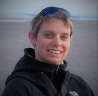
Carol Lockhart
Moderator/Chief Hydrologist

Carol Lockhart is a well-known and highly respected expert in hydrographic and bathymetric surveying. She is highly skilled in developing process workflows for new technology and managing large volume datasets for hydrographic surveying projects. Her strong technical background encompasses all aspects of hydrographic and bathymetric surveying and is unparalleled in the industry. Leveraging skills beyond data processing, analysis, charting, visualization, GIS, charting, and technology, Ms. Lockhart is a leader in business development.

Vikki Lukas
Acting Deputy Associate Director, Core Science Systems

Vicki Lukas is the Acting Deputy Associate Director in the National Geospatial Program (NGP) of the USGS, where she oversees the 3D Elevation Program and the National Hydrography Datasets of The National Map. Vicki has over 25 years of experience as a Geographer at the USGS. Past positions include overseeing partnership activities of The National Map and the national network of Liaisons, serving as a mapping liaison in the western U.S., and beginning her career in digital geologic mapping. Vicki has been the project lead on multiple mapping coordination initiatives, including the 3DEP Executive Forum, the Alaska Mapping Roundtable and Executive Committee, and the project team of the National States Geographic Information Council and National Association of Counties to develop partnering mechanisms for The National Map program.
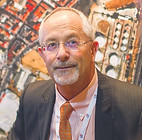
Brian Raber
GISP

Brian has been with Merrick & Company for almost 30 years, and was a Vice President for 20 years. During his years at Merrick, Brian’s geomatics teams strategically grew in domestic and international revenue. Brian has Geography and cartography degrees from West Virginia University and the University of Idaho.
Brian has been certified by the American Society of Photogrammetry and Remote Sensing (ASPRS), Urban and Regional Information Association (URISA), and held a geospatial surveyor license in the state of South Carolina. Merrick’s thought leadership has been recognized by many organizations, including the MAPPS Project of the Year, ACEC Excellence Awards, DigitalGlobe Latin American Innovator of the Year, State of Colorado Exporter of the Year, and Geo Project of the Year by the LATAM Geospatial Forum.
Brian also gives back to his community and geospatial profession. He is engaged in geospatial political advocacy as the current MAPPS Past President, mentors’ teenage students at his Catholic church, and is a Director on the West Virginia University Visiting Industry Committee and the non-profit World Trade Center Denver. During his career, Brian delivered 98 conference presentations, and published 33 professional papers.
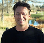
Jason Stoker
Acting Chief, USGS NGP Topographic Data Services

Dr. Jason Stoker is a US Geological Survey Physical Scientist for the National Geospatial Program. Jason oversees strategic planning, development and coordination of the 3D Elevation Program and science and application related data, tools, and services.
.jpg)
Jennifer Wozencraft
Research Physical Scientist,

Jennifer Wozencraft is a Research Physical Scientist in the Coastal and Hydraulics Laboratory of the U.S. Army Corps of Engineers (USACE) Engineer Research and Development Center, and Director of the Joint Airborne Lidar Bathymetry Technical Center of Expertise (JALBTCX). At JALBTCX, she coordinates operations, research, and development in airborne coastal mapping technologies among USACE, Naval Oceanographic Office, National Oceanic and Atmospheric Administration, and U.S. Geological Survey. She also manages the USACE National Coastal Mapping Program, which provides regional scale, engineering-accuracy elevation, depth, and imagery data to support USACE regional sediment management, navigation, environmental restoration, regulatory enforcement, asset management and emergency response activities in the coastal zone. Ms. Wozencraft represents USACE as co-chair of the Interagency Working Group on Ocean and Coastal Mapping.


.png)

.png)
.jpg)


